Aircraft / Avionics Orders: 800.447.3408 Radio Control Orders: 877.219.4489
AeroNav
AERONAV T
VFR Terminal Area Chart by US City
VFR Terminal Area Chart by US City
$6.20
VFR Terminal Area Chart by US City, from AeroNav
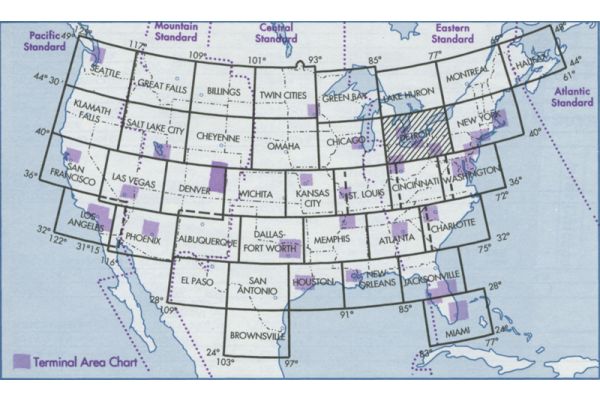
Terminal Area Charts (TAC Charts) usually depict the airspace designated as Class B airspace; the Puerto Rico-Virgin Islands Terminal Area Chart is based on Class C airspace the the Anchorage/Fairbanks Terminal Area Chart is based on Class C airspace (Anchorage) and a Terminal Radar Service Area (TRSA) (Fairbanks).
The information found on these charts, while similar to that found on Sectional Charts, is shown in much more detail because of the larger scale. These charts should be used by pilots intending to operate from airfields within a near Class B airspace, Class C airspace or a Terminal Radar Service Area. Coverage of Terminal Area Charts is indicated by shaded boxes on the Sectional Chart index. (Scale 1 inch - 3.4nm/ 1:250,000; various sizes folded to 5 x 10 inches) Revised semi-annually, except Puerto Rico-Virgin Islands which is revised annually.
| AERONAV Aeronautical Charts - Terminal Area Navigation Chart Region Listing | ||
|---|---|---|
|
|
|