Aircraft / Avionics Orders: 800.447.3408 Radio Control Orders: 877.219.4489
AeroNav
AERONAV USPLAN
US IFR/ VFR Low Altitude Planning Chart , Folded
US IFR/ VFR Low Altitude Planning Chart , Folded
$7.50
US IFR/ VFR Low Altitude Planning Chart , Folded, from AeroNav
Aeronautical planning charts are used for pre-flight planning of long flights. Selected routes should be transferred to more detailed charts for navigation.
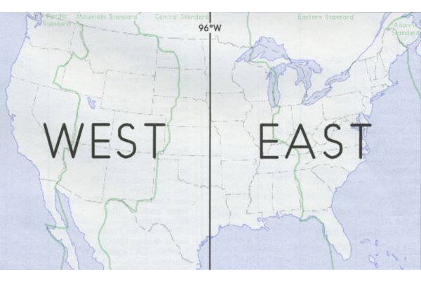
U.S. IFR/VFR Low Altitude Planning Chart is designed for pre-flight and enroute flight planning for IFR/VFR flights. The chart is printed front-East, back-West, with insets for the east coast from Washington, D.C. to Boston and on the west coast, from the Los Angeles to the San Diego area.
Information includes the depiction of low altitude LF/MF and VHF airways and mileages, low altitude navigational facilities, airports with 3,000' hard-surfaced runways or greater, special use airspace areas, cities, time zones, major drainage, and a directory of airports with their airspace classification and a mileage table showing great circle distances between major airports. (Scale 1 inch = 47nm/ 1:3,400,000; 40 x 36 inches flat, or folded to 5 x 9 inches) Revised annually.